Laser Survey & Scanning
we can bring the offshore asset to your desktop
OVERVIEW
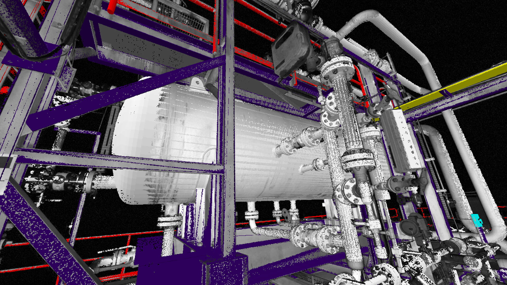
Offshore & Onshore Laser Survey & Scanning is the latest addition to R&M’s portfolio of services, providing dimensional survey through the most advanced laser scanner technology.
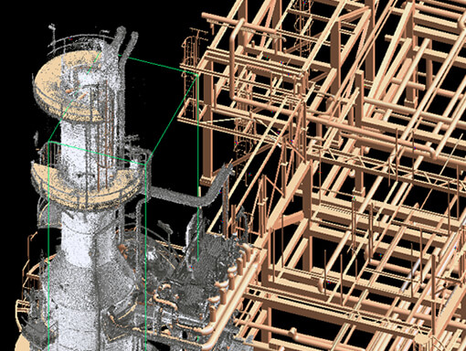
All this is possible with the utilisation of state of the art survey equipment combined with proprietary software, creating three-dimensional models and a 360 degree wrap around image database (Point Cloud Database), with exceptional accuracy.
01.
High accuracy survey and fabrication control
02.
03.
04.
05.
06.
07.
DIMENSIONAL CONTROL
01.
Brownfield piping and structural modifications including “like for like” replacement
02.
Verification of new design piping systems to assure clash free installation without the need for “field-fit” and interference free
03.
Offshore Hook-ups
04.
05.

SURVEY SERVICES
01.
State-of-the-art 3D Laser Scanners and Total Station survey devices
02.
Used onshore and offshore
03.
- Verification of new design route “corridors”
- High accuracy survey and fabrication control
- Vendor inspection
- Intelligent 3D Model and Spatial 3D Model
04.
05.